If you have apples, you should not
compare them with pears!
German saying
So when you compare the burned areas of #forests in #Indonesia in 2015 with the size of Germany, like SPIEGEL ONLINE (and others did today), you should not take a political map with wrong area dimensions to show the area. That’s nonsense, a huge exaggeration and falsification.
Actually Indonesia is more than 5 times bigger than Germany, but in this Map (without the zoom in) Germany would already look bigger than Indonesia at all! So one migth think that whole Indonesia was burning this year, what actually was not the case.
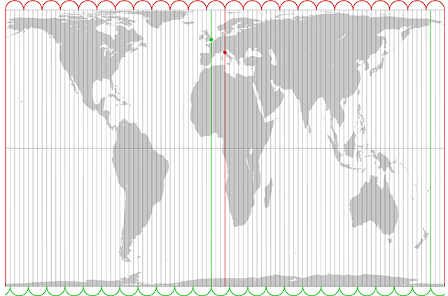
If you want to compare areas, you should take a equal area projection like the Peters projection (which admittedly looks kind of unusual, but describes the areas in a right relation)
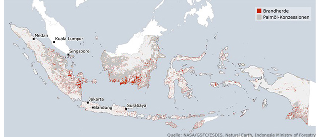
First Step: Cleaned-up map with grey color for the palm oil concessions for a much better understanding. The orange color combined with red is misleading: If red is fire area, orange seems to be a fire threat.
Erster Schritt: Aufgeräumte Karte mit grauen Palmöl-Konzessionen zur besseren Übersicht . Die orangenen Flächen in Kombination mit Rot vermitteln einen irreführenden Zusammenhang: wenn Rot Brände darstellt, scheint Orange z.B. Brandgefahr zu bedeuten.

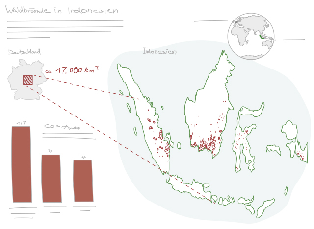
Second Step: Alternative proposal with both images combined in one layout. Germany and Indonesia are in the correct ratio regarding their area, now using the equal-area Peters-Projection. Look at the difference!
Zweiter Schritt: Alternativer Vorschlag bei dem beide Grafiken auf einem Format zusammen gebracht wurden. �Deutschland und Indonesien stehen nun im korrekten Flächenverhältnis zu einander und sind nach �der flächentreuen Peters-Projektion richtig dargestellt. Schauen Sie sich den erheblichen Unterschied an!

Peters-Projection: Correct ratio of area
Peters-Projektion: Korrekte Darstellung der Flächenverhältnisse

 Menu Mobile
 Menu Mobile